

The Most Plotted Map Location — Null Island
Thousands of markers point to it, but there's nothing there.


If you have ever developed anything that requires longitude and latitude, congratulations, you’ve probably contributed to the popularity of the Null Island.
It's the spot at 0°N, 0°E — the intersection of the equator and the prime meridian — and it's one of the most densely populated points on every map of the world.
Except, nobody lives there. There's no land. The ocean is two miles deep. It's the place your data goes when it's wrong.
How does this happen
As a developer of map tools at least one of the below has bitten you:
A geocoder returns
{ lat: 0, lon: 0 }on a soft failure instead of an error.A CSV column has empty cells and your loader coerces them to numbers.
parseFloat("")isNaN;Number("")is0. Guess which one your code uses.A user record was created before location was captured. The schema requires
NOT NULL, so the migration filled0.0.A GPS device powers on, fails to acquire a lock, and emits a
$GPGGAsentence with zeros until satellites are found. Some logger writes that first sentence anyway.Your reverse-geocoded data went through a coordinate reference system transform with the wrong source CRS. Half the points are at
(0, 0)because the transform is degenerate.An iOS user denied location permission. Your app sent the default placeholder it was initialised with.
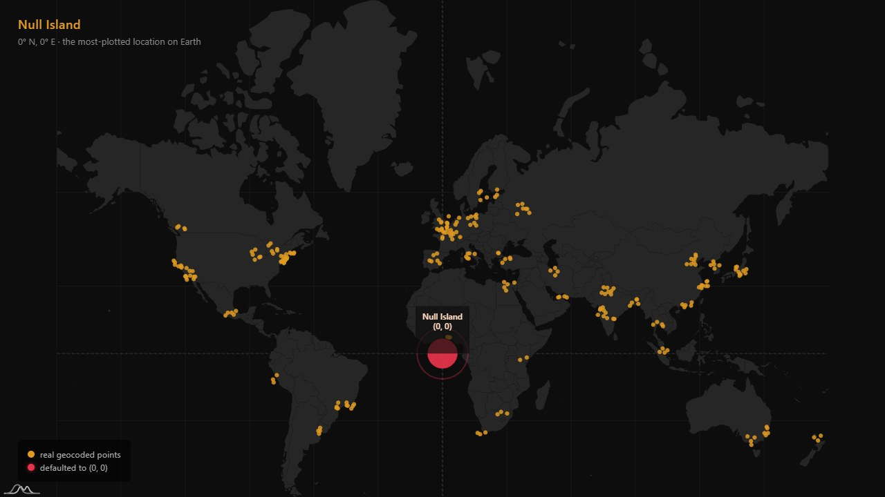
The end result is always the same. You open the map. There is a giant red dot in the Gulf of Guinea, just off the coast of Ghana. Sometimes it’s so dense it forms its own continent.
Where this actually is
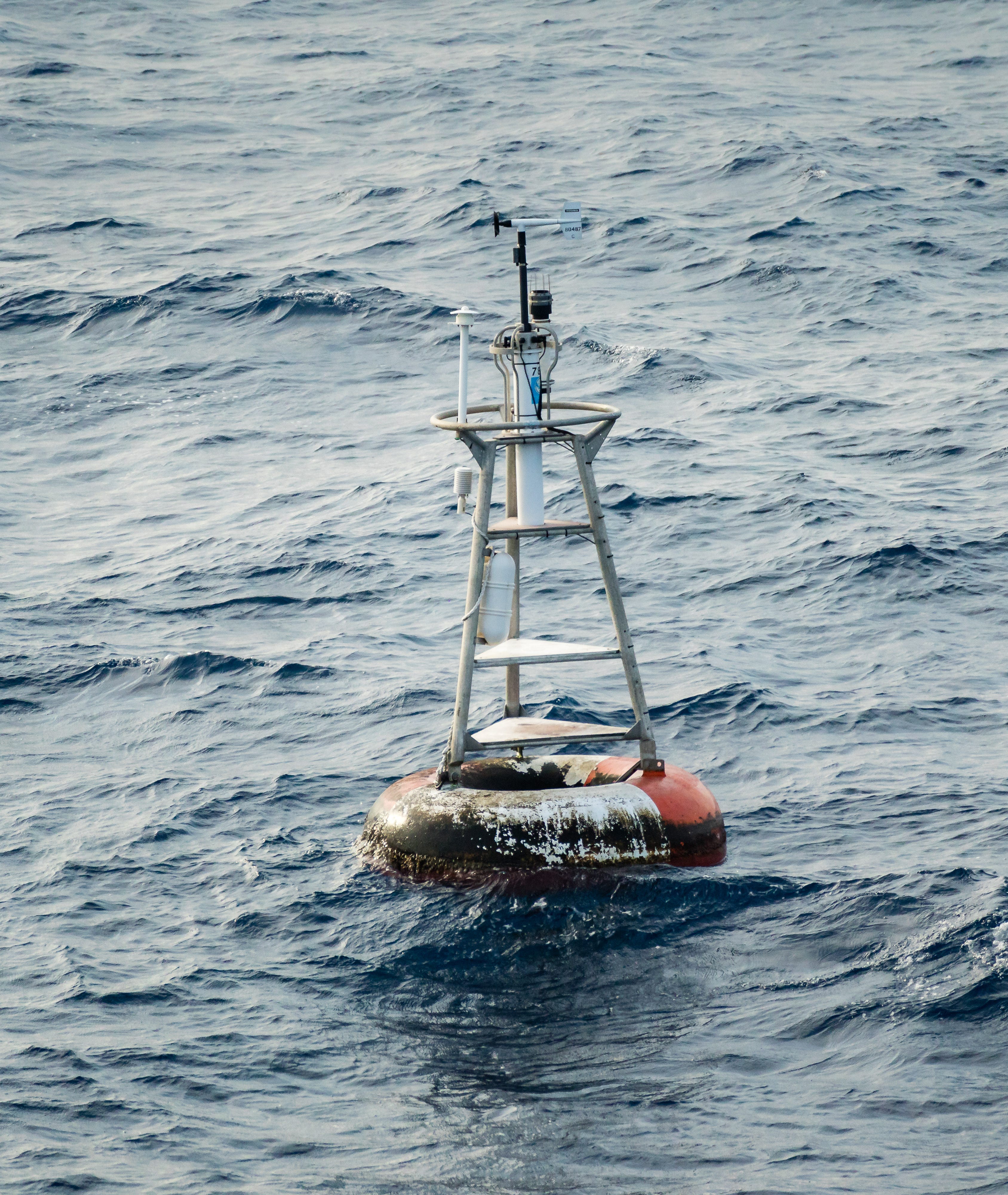
Null Island is in international waters in the Atlantic, about 600 km south of Accra. The water is 4,940 metres deep. There is no island. There was, until 2021, a buoy.
“Soul” was part of PIRATA, a network of 17 buoys in the tropical Atlantic that the US, France, and Brazil have run jointly since 1997 for climate research. PIRATA buoys are named after musical genres, which is delightful. The decommissioning of Soul in 2021 means there is now technically nothing at the surface at 0,0 except whatever current data your service is sending there.
The meme
The geospatial community noticed the pattern a long time ago. The name “Null Island” was coined around 2008 by Steve Pellegrin, who put up a satirical “Republic of Null Island” website. In 2010 Mike Migurski at Stamen added a 100-metre island shape to the company’s Acetate basemap as an inside joke; the shape was traced from the fictional island in Myst. Stamen’s Toner and Terrain tile sets carried it forward.
In 2011 Null Island showed up in Natural Earth, the public-domain GIS dataset that ships with QGIS and many other tools, as a 1-square-metre island with a “scale rank” of 100 — the value used to mark “this should never actually be drawn at any zoom level.” It was a flag for buggy data, encoded as a feature.
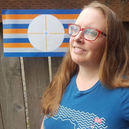
And of course someone made a flag.
How big it is depends on who’s wrong
Different data products have given Null Island different sizes, in a way that mirrors how seriously their authors took the joke:
Natural Earth v1.3 — 1 metre square. The minimum representable feature.
Natural Earth v4.1 (2018) — 1 km square. Promoted.
Stamen Acetate (Mike Migurski, 2010) — about 100 m, traced from Myst.
ESRI (Nicholas Furness) — about 10 km. Roughly the width of San Francisco.
The Null Island region has, in other words, been “annexed” by successively more ambitious vector data layers. Stamen calls this “null-flation.”
Where you can actually see it leak
The really fun thing about Null Island is that it shows up in real public datasets if you go looking. Stamen’s blog post lists a few that are still observable:
OpenStreetMap has a “scribble-like hairball of lines” at 0,0 from broken GPS uploads. You can see it in the OSM tile cache logs as a perpetual hot spot.
Strava’s heatmap contains ghostly traces of running routes around the location — runners whose devices lost their fix.
PurpleAir (the home-air-quality network) has misconfigured sensors reporting from 0,0.
Weather Underground has shown weather stations physically located in Austria and Arizona that report their position as Null Island.
In 2021 Facebook briefly used a Stamen basemap that included the Null Island feature in their friend recommendations product. Andrew Wiseman and Chris Whong noticed Facebook’s “find friends” recommender, when it had no candidates to suggest, was zooming in on Null Island as the location it thought you were from. Meta later took the basemap out.
This is the funny part of the joke. The bug is recursive. Software defaults to zero, the joke island gets put on a map to mark the bug, the joke island gets indexed by other software as a real place, and then a recommendation engine starts suggesting it.
The recursion is the point
The most-plotted location on Earth has no land, no people, and as of 2021 not even a buoy on the surface to look at. It exists entirely as the artefact of a default value. Every system you write that touches coordinates contributes to it a little. Somewhere on a NOAA seafloor map there is a small notation marking the empty water at 0,0. Somewhere on a Wikipedia draft there is a flag and a national anthem that someone composed for it. Somewhere in your production database there are 47 rows whose created_by is some intern from 2019.
It’s a place that exists only because we keep accidentally putting things there.
DataViz Dojo was created by amCharts team. We’re not here to peddle you our data-viz lib. We’re here to have fun with facts, data, cartography, and history, blending it all into beautiful visual stories. Subscribe, follow, or simply check in regularly for more compelling stuff!
 | A guest post by
|